


More choppers provide more eyes in the skies for Powercor’s vegetation program
24 November, 2023
 Powercor is taking to the skies this month with an expanded helicopter fleet as it gets ahead of next year’s powerline inspection program in central, northern and western Victoria.
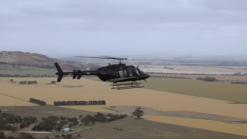
By adding another specially-designed helicopter to its fleet, Powercor will inspect more than 75,000 kilometres of powerlines as part of its extensive vegetation management program designed to keep power safe and reliable for homes and businesses.
The inspection program for the upcoming 2023-24 summer was completed in July – 10 weeks earlier than last year – and additional pre-summer inspections in high-risk areas have also been conducted.
Headed up by a team of highly qualified pilots, three helicopters will begin the 2024 program over Colac, Camperdown and Warrnambool regions through November and December.
Powercor spokesman Ayce Cordy said having three helicopters available would further enhance Powercor’s vegetation management – a critical part of its bushfire safety program.
“We are always improving how we inspect and manage vegetation across our network to make sure our network is prepared and as safe as possible heading into the hotter months,” Mr Cordy said.
“By adding an extra helicopter to our flying roster, we will be able to inspect the network quicker to identify when and where we need to cut back trees growing near powerlines.
“While the 2024-25 summer seasons is still well over 12 months away, these latest aerial inspections will allow us to plan and prepare our cutting program well in advance.”
This year, Powercor has already cut 360,000 trees away from powerlines in hazardous bushfire risk areas. This is an increase on 2022 and follows a 30% increase in cutting resources across the network.
Fire danger periods have already been declared in 12 council areas within Powercor’s network ahead of this summer.
The aerial powerline inspections use Light Detection and Ranging (LiDAR) technology to accurately identify the distances of trees to powerlines. The data forms a 3D model of the network and is fed to experienced teams to analyse which trees need to be cut.
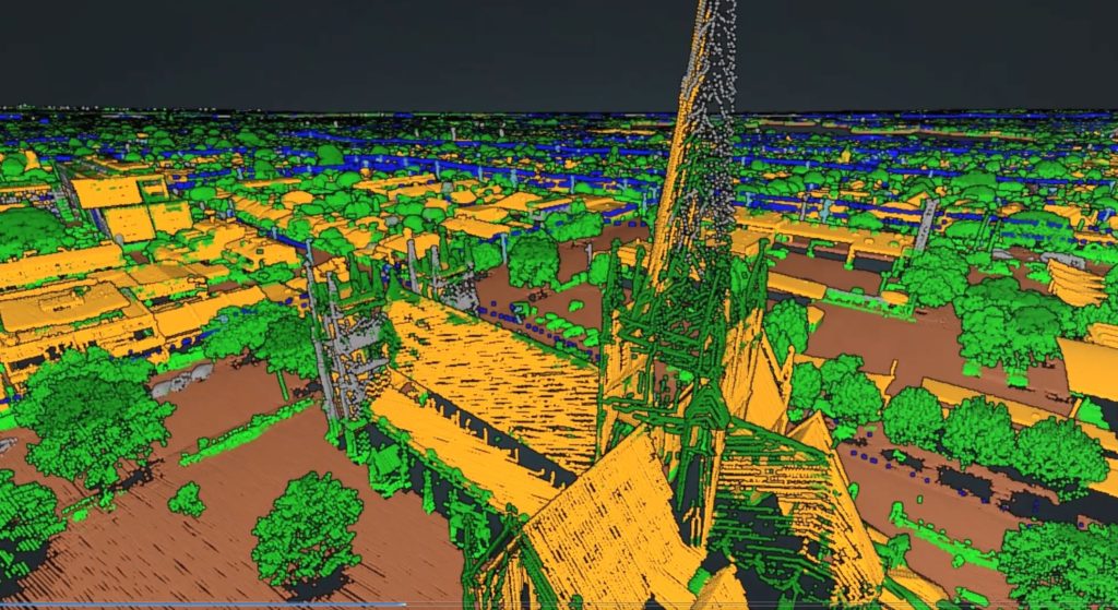
From a height of 300 metres above, helicopter-mounted LiDAR can accurately measure the distance between trees and powerlines to within centimetres.
Powercor has made significant investments towards improving its vegetation management in recent years, including bringing its aerial capacity and LiDAR data analysis in-house and implementing a new system to significantly improve delivery of the program.
Powercor is responsible for the cutting of trees near its powerlines within the boundaries of private properties and on some parts of public land (typically in rural areas) as designated by the state safety regulator, Energy Safe Victoria.
How our cutting program works
- Our trained cutting teams can enter private property to cut trees back from powerlines, and also work on public land across our network.
- Our teams need to meet clearance requirements that are regulated by Victoria’s energy safety regulator, Energy Safe Victoria (ESV).
- Larger clearance areas are required in areas of higher bushfire risk.
- For private property, our teams notify customers of cutting required at their address, complete the required pruning work then return to remove debris.
- When urgent cutting is identified, we aren’t always able to provide advance notice.
The helicopter fleet
- One Bell 407 helicopter
- Crew: Two pilots per aircraft
- Top speed: 260km/h
- Range: 870km
- Aircraft length: 12.62m
- Aircraft height: 3.33m
- LiDAR system: RIEGL VUX-240
- Slow cruise speed for LiDAR capture: 129km/h
- LiDAR scan speed: 1.8MHz and 400 lines per second
- Data capture: 1TB per day
- Two Bell 505 helicopters
- Crew: Two pilots per aircraft
- Top speed: 232km/h
- Range: 617km
- Aircraft length: 12.93m
- Aircraft height: 3.25m
- LiDAR system: RIEGL VUX-240
- Slow cruise speed for LiDAR capture: 129km/h
- LiDAR scan speed: 1.8MHz and 400 lines per second
- Data capture: 1TB per aircraft per day


