


Powercor flying above Geelong and Surf Coast to keep communities safe
20 March, 2024
Helicopters are scanning powerlines in the Geelong and Surf Coast areas during the next few weeks, as part of Powercor’s year-round bushfire mitigation and vegetation management program.
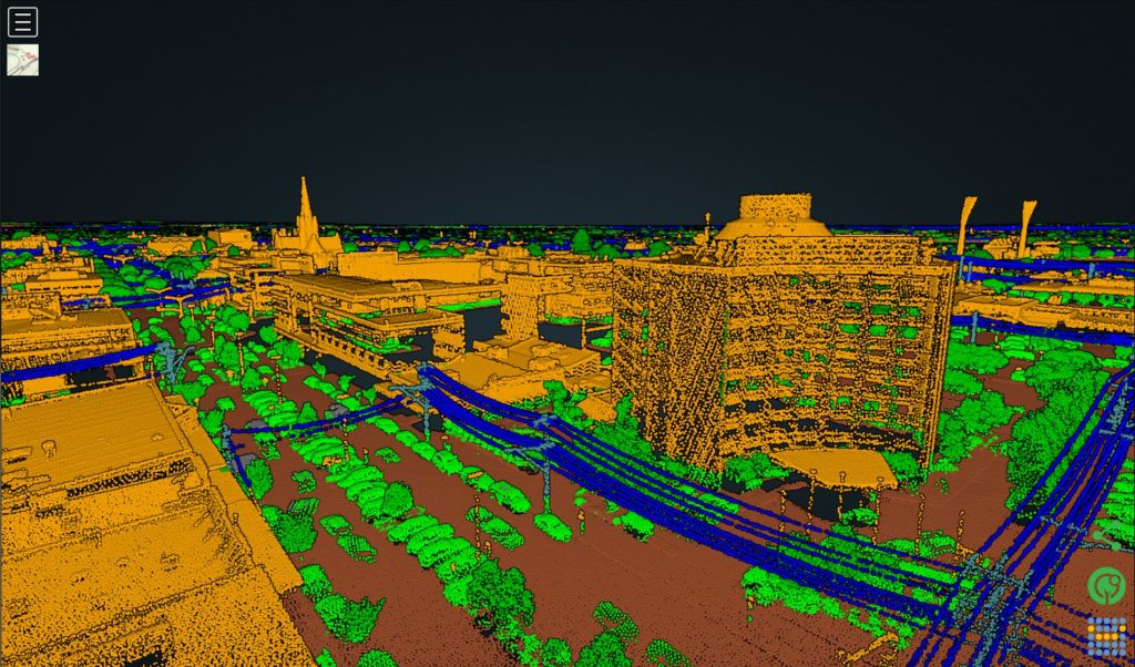
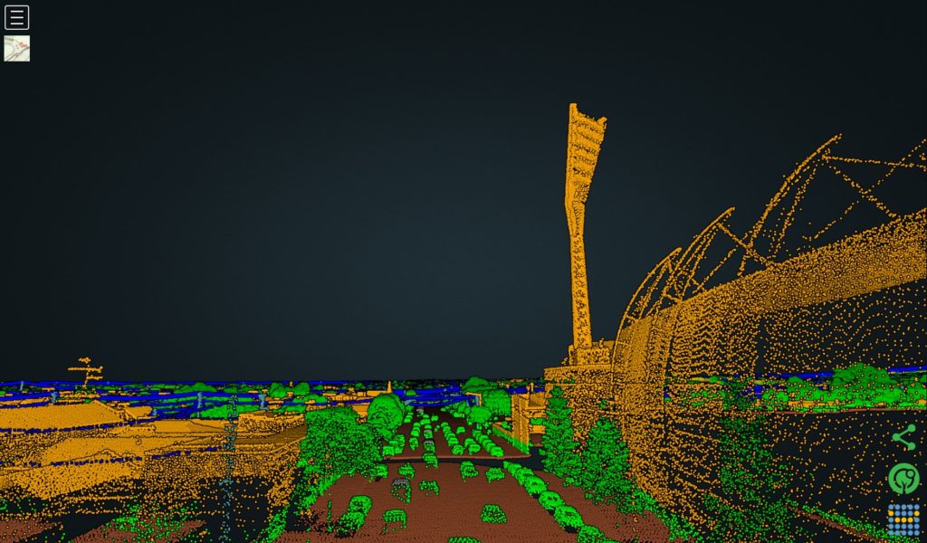
People may see and hear the choppers, which fly about 300 metres above the ground and use technology known as Light Detection and Ranging (LiDAR) to scan the distance between tree branches and powerlines.
Using the LiDAR data, Powercor teams create 3D models of powerlines and their surroundings, helping to inform what vegetation needs to be cut.
Year-on-year data also helps keep track of growth rates for different vegetation types, allowing cutting teams to plan ahead for areas that show faster growth.
Powercor’s Head of Vegetation Management, Ayce Cordy, said the extensive vegetation management program was about keeping power safe and reliable for homes and businesses.
“Our work is about reducing the risk of trees and branches coming into contact with powerlines, which can lead to power outages and fires,” Mr Cordy said.
“These flights are just part of our extensive work to keep the network safe and reliable for our communities.”
The helicopters will be scanning powerlines in and around Geelong as well as towns along the surf coast, but also rural areas in the region.
Each year Powercor uses a fleet of three helicopters to inspect 100 per cent of more than 77,000 kilometres of powerlines across western Victoria.
During 2023, teams cut more than 500,000 trees and shrubs growing near more than 50,000 powerline spans (the distance between two poles).
Last year, Powercor’s vegetation team conducted a second vegetation inspection in the highest bushfire risk areas to help inform any further cutting that may need to occur ahead of summer.
Since 2022, Powercor has increased its cutting resources by 60% across the network.
Powercor is responsible for the cutting of trees near its powerlines within the boundaries of private properties and on some parts of public land (typically in rural areas) as designated by the state safety regulator, Energy Safe Victoria.
How our cutting program works
- Our trained cutting teams can enter private property to cut trees back from powerlines, and also work on public land across our network.
- Our teams need to meet clearance requirements that are regulated by Victoria’s energy safety regulator, Energy Safe Victoria (ESV).
- Larger clearance areas are required in areas of higher bushfire risk.
- For private property, our teams notify customers of cutting required at their address, complete the required pruning work then return to remove debris.
- When urgent cutting is identified, we aren’t always able to provide advance notice.
The helicopter fleet
One Bell 407 helicopter
- Crew: One Pilot and one LiDAR System Operator per aircraft
- Top speed: 260km/h
- Range: 870km
- Aircraft length: 12.62m
- Aircraft height: 3.33m
- LiDAR system: RIEGL VUX-240
- Slow cruise speed for LiDAR capture: 129km/h
- LiDAR scan speed: 1.8MHz and 400 lines per second
- Data capture: 1TB per day
Two Bell 505 helicopters
- Crew: One Pilot and one LiDAR System Operator per aircraft
- Top speed: 232km/h
- Range: 617km
- Aircraft length: 12.93m
- Aircraft height: 3.25m
- LiDAR system: RIEGL VUX-240
- Slow cruise speed for LiDAR capture: 129km/h
- LiDAR scan speed: 1.8MHz and 400 lines per second
- Data capture: 1TB per aircraft per day


